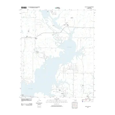
2010 Map of Little City
USGS Topo · Published 2010About this map
Fort Washita stands as a focal point of this Oklahoma landscape, situated just east of the northern reaches of Lake Texoma. This area preserves significant military and genealogical history through the Post Cemetery and Confederate Cemetery, as well as the Zachary Taylor landmark. The landscape is heavily defined by the energy industry and water management, featuring the Cumberland Oil Field and the Southeast Aylesworth Oil Field alongside the protective Cumberland Levee. Small rural settlements like Cumberland, Little City, and Bee are connected by a grid of section line roads, while the southern portion of the map is dominated by the expansive waters of the lake. The Roosevelt Memorial Bridge serves as a critical crossing point, anchoring the transportation network near the community of Mead.
Find a feature on this map
44 named features on this map. Tap any name to fly to it.
Don’t see what you’re looking for? This feature index may not catch every label — zoom into the map to look around manually.
Map Details
Editions of this 2010 Little City Map
This is the sole edition of this map. No revisions or reprints were ever made.
Other maps of this area

1899 · Atoka
USGS Topo · 1:125,000

1900 · Atoka
USGS Topo · 1:125,000

1901 · Tishomingo
USGS Topo · 1:125,000

1901 · Denison
USGS Topo · 1:125,000

1954 · Sherman
USGS Topo · 1:250,000

1957 · Ardmore
USGS Topo · 1:250,000

1958 · Durant
USGS Topo · 1:62,500

1958 · Denison Dam
USGS Topo · 1:62,500

1958 · Sherman
USGS Topo · 1:250,000

1963 · Ardmore
USGS Topo · 1:250,000