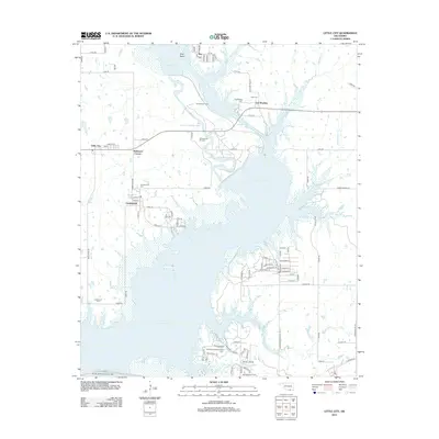
2012 Map of Little City
USGS Topo · Published 2012About this map
Fort Washita anchors the northern landscape of this Oklahoma survey, a site of significant historical weight near the Cumberland Levee. The area is characterized by the expansive waters of Lake Texoma, which has reshaped the local geography, isolating Goat Island and submerging portions of the Old Channel Washita River. The map reveals a region deeply tied to resource extraction and history, evidenced by the Cumberland Oil Field and Southeast Aylesworth Oil Field. Genealogy and local history researchers will find several burial grounds, including the Confederate Cem and Post Cem, alongside smaller family or community locations like Aylesworth Cem. Small settlements such as Little City, Bee, and Robinson Corner are connected by a network of rural roads that navigate around the inlets and marshes of the lake, where the Cumberland Cut provides a distinct engineering mark on the river's original path.
Find a feature on this map
95 named features on this map. Tap any name to fly to it.
Don’t see what you’re looking for? This feature index may not catch every label — zoom into the map to look around manually.
Map Details
Editions of this 2012 Little City Map
This is the sole edition of this map. No revisions or reprints were ever made.
Other maps of this area

1899 · Atoka
USGS Topo · 1:125,000

1900 · Atoka
USGS Topo · 1:125,000

1901 · Tishomingo
USGS Topo · 1:125,000

1901 · Denison
USGS Topo · 1:125,000

1954 · Sherman
USGS Topo · 1:250,000

1957 · Ardmore
USGS Topo · 1:250,000

1958 · Durant
USGS Topo · 1:62,500

1958 · Denison Dam
USGS Topo · 1:62,500

1958 · Sherman
USGS Topo · 1:250,000

1963 · Ardmore
USGS Topo · 1:250,000