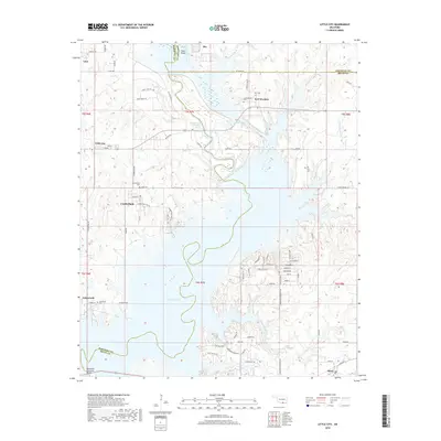
2018 Map of Little City
USGS Topo · Published 2018About this map
Fort Washita anchors the northern portion of this landscape, a significant frontier site situated near the Confederate Cem and Post Cem. The area is defined by the expansive waters of Lake Texoma, which has transformed the historical confluence of the Washita River and its various tributaries. The map documents the complex shoreline created by the reservoir, including the Old Channel Washita River and the engineering of the Cumberland Cut, which diverted the river's path. Smaller settlements like Little City, Cumberland, and Aylesworth dot the upland areas above the waterline, connected by a network of rural roads such as the Zachary Taylor highway. Genealogists will find several burial grounds noted, including the Cumberland Cem and Aylesworth Cem, providing essential markers for families tied to these Red River valley communities.
Find a feature on this map
87 named features on this map. Tap any name to fly to it.
Don’t see what you’re looking for? This feature index may not catch every label — zoom into the map to look around manually.
Map Details
Editions of this 2018 Little City Map
This is the sole edition of this map. No revisions or reprints were ever made.
Other maps of this area

1899 · Atoka
USGS Topo · 1:125,000

1900 · Atoka
USGS Topo · 1:125,000

1901 · Tishomingo
USGS Topo · 1:125,000

1901 · Denison
USGS Topo · 1:125,000

1954 · Sherman
USGS Topo · 1:250,000

1957 · Ardmore
USGS Topo · 1:250,000

1958 · Durant
USGS Topo · 1:62,500

1958 · Denison Dam
USGS Topo · 1:62,500

1958 · Sherman
USGS Topo · 1:250,000

1963 · Ardmore
USGS Topo · 1:250,000