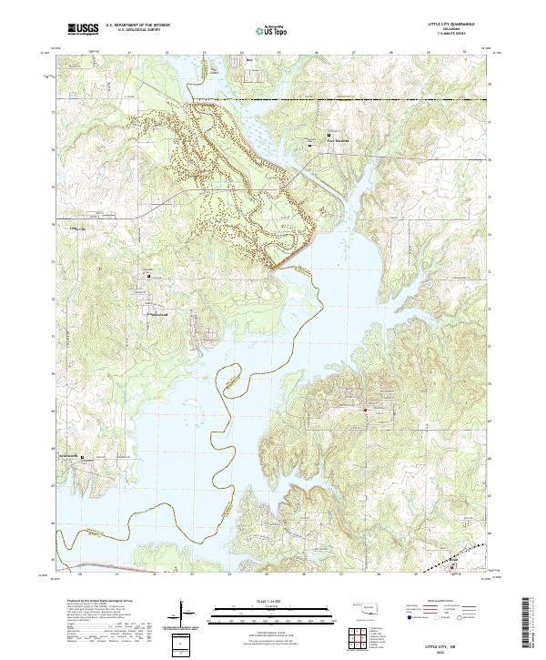
2022 Map of Little City
USGS Topo · Published 2022About this map
Fort Washita stands as a prominent historical anchor in this northern section of the Lake Texoma region, where the Washita River and its intricate tributaries dominate the landscape. The map details a complex hydrologic environment featuring the Cumberland Cut and the Old Channel Washita River, reflecting the significant engineering and natural shifts in the river's course over time. Small settlements like Little City, Cumberland, and Bee are distributed across the higher ground, often proximal to local cemeteries such as the Confederate Cem and Post Cem near the fort. These sites, along with Aylesworth and Mead to the south, are connected by a network of rural roads like Oil Bottom Ln and Union Ridge Ln. The terrain is characterized by the winding paths of Rock Creek and Newberry Cr, which carve through the Oklahoma countryside toward the major river system.
Find a feature on this map
81 named features on this map. Tap any name to fly to it.
Don’t see what you’re looking for? This feature index may not catch every label — zoom into the map to look around manually.
Map Details
Editions of this 2022 Little City Map
This is the sole edition of this map. No revisions or reprints were ever made.
Other maps of this area

1899 · Atoka
USGS Topo · 1:125,000

1900 · Atoka
USGS Topo · 1:125,000

1901 · Tishomingo
USGS Topo · 1:125,000

1901 · Denison
USGS Topo · 1:125,000

1954 · Sherman
USGS Topo · 1:250,000

1957 · Ardmore
USGS Topo · 1:250,000

1958 · Durant
USGS Topo · 1:62,500

1958 · Denison Dam
USGS Topo · 1:62,500

1958 · Sherman
USGS Topo · 1:250,000

1963 · Ardmore
USGS Topo · 1:250,000