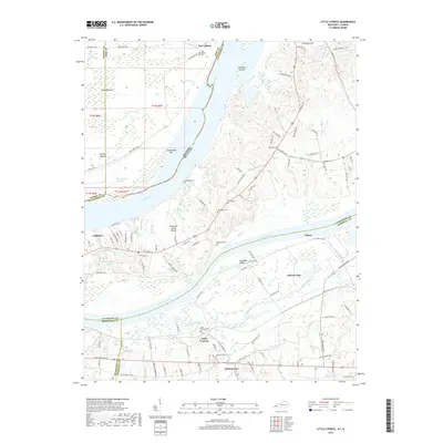
2019 Map of Little Cypress
USGS Topo · Published 2019About this map
The Tennessee River and Ohio River converge in this riverine landscape, defining a complex network of sloughs, bars, and ridges. Along the northern banks, the Kincaid Mounds stand as a significant prehistoric landmark near Black Bottom, while the contemporary industrial presence of Calvert City dominates the southern shore. The topography is shaped by the Tennessee Valley Divide and Saunders Ridge, which separate the various drainages like Cypress Creek and Mud Creek.
Find a feature on this map
126 named features on this map. Tap any name to fly to it.
Don’t see what you’re looking for? This feature index may not catch every label — zoom into the map to look around manually.
Map Details
Editions of this 2019 Little Cypress Map
This is the sole edition of this map. No revisions or reprints were ever made.
Other maps of this area

1926 · Paducah
USGS Topo · 1:62,500

1929 · Smithland
USGS Topo · 1:62,500

1929 · Paducah
USGS Topo · 1:62,500

1936 · Paducah
USGS Topo · 1:24,000

1936 · Elva
USGS Topo · 1:24,000

1936 · Smithland
USGS Topo · 1:48,000

1936 · Symsonia
USGS Topo · 1:24,000

1936 · Benton
USGS Topo · 1:48,000
1936 · Calvert City
USGS Topo · 1:24,000

1936 · Little Cypress
USGS Topo · 1:24,000