
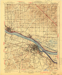
1926 Map of Paducah
USGS Topo · Published 1967About this map
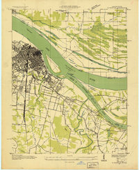
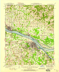
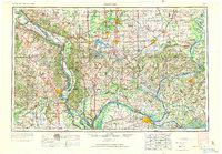
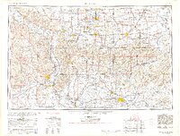
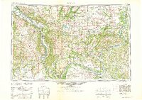
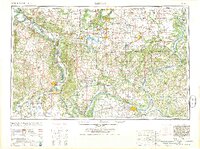
Paducah stands as a significant river and rail hub at the confluence of the Ohio River and the Tennessee River, where the Nashville Chattanooga And St Louis Railroad and the Illinois Central Railroad converge. The landscape reveals a densely developed network of arterial roads like the Mayfield Road and Hinkleville Road, connecting outlying settlements such as Lone Oak and Avondale Heights to the urban core. Across the river in Illinois, Metropolis and Brookport serve as important northern anchor points.
Find a feature on this map
105 named features on this map. Tap any name to fly to it.
Don’t see what you’re looking for? This feature index may not catch every label — zoom into the map to look around manually.
Map Details
Editions of this 1926 Paducah Map
This is the sole edition of this map. No revisions or reprints were ever made.
Historical Maps of Paducah Through Time
12 maps found
1926 Paducah
McCracken County, KY
1929 Paducah
McCracken County, KY
1936 Paducah
McCracken County, KY
1940 Paducah
McCracken County, KY
1949 Paducah
McCracken County, KY

1950 Paducah
McCracken County, KY
1954 Paducah
McCracken County, KY
1961 Paducah
McCracken County, KY
1964 Paducah
McCracken County, KY

1984 Paducah
McCracken County, KY

1986 Paducah
McCracken County, KY

1987 Paducah
McCracken County, KY