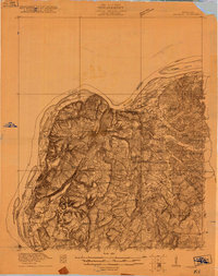
1920 Map of Goloonda
USGS Topo · Published 1920About this map
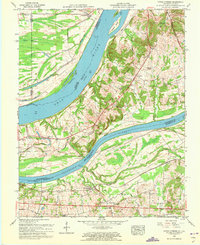
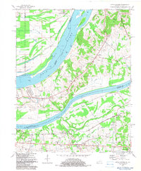
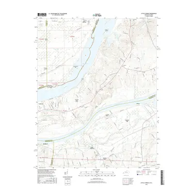
Ohio River frontage and the sprawling wetlands of Big Cypress Swamp define this 1920 survey of western Kentucky. The landscape is heavily dotted with rural institutions, showing a dense network of one-room schoolhouses like Duley Bluff School, Valley Forge School, and Threlkeld School that served the dispersed farming population. Religious life is equally well-represented through landmarks such as Love Chapel and Mt Pisgah Church.
Find a feature on this map
45 named features on this map. Tap any name to fly to it.
Don’t see what you’re looking for? This feature index may not catch every label — zoom into the map to look around manually.
Map Details
Editions of this 1920 Goloonda Map
This is the sole edition of this map. No revisions or reprints were ever made.
Historical Maps of Rosiclare Through Time
16 maps found
1920 Goloonda
Livingston County, KY
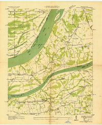
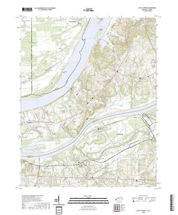
1936 Little Cypress
Livingston County, KY
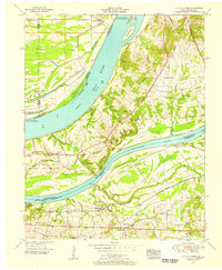
1954 Little Cypress
Livingston County, KY
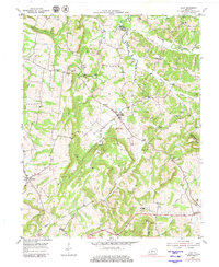
1954 Lola
Livingston County, KY
1958 Little Cypress
Livingston County, KY
1982 Little Cypress
Livingston County, KY

2010 Little Cypress
Livingston County, KY
2010 Lola
Livingston County, KY

2013 Little Cypress
Livingston County, KY
2013 Lola
Livingston County, KY
2016 Little Cypress
Livingston County, KY
2016 Lola
Livingston County, KY

2019 Little Cypress
Livingston County, KY
2019 Lola
Livingston County, KY
2022 Little Cypress
Livingston County, KY

2022 Lola
Livingston County, KY