
1916 Map of Equality
USGS Topo · Published 1916About this map
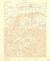
The Saline River winds across this Southern Illinois landscape, providing a primary corridor for the village of Equality. This 1913-1914 survey captures a rural economy deeply integrated with its geography, where narrow hollows like Maher Hill Hollow and Caplin Vineyard Hollow separate prominent heights including Eagle Creek Mountain and the Wildcat Hills. The map serves as a detailed record of early twentieth-century industry, showing the location of the Illinois Furnace, Lees Mines, and the Pierce Mines, alongside essential local processing sites like Wolrab Mill. A dense network of one-room schoolhouses, such as Pisgah School and Clover Glen School, indicates the distribution of rural family life across the county lines of Saline, Gallatin, Pope, and Hardin.
Find a feature on this map
102 named features on this map. Tap any name to fly to it.
Don’t see what you’re looking for? This feature index may not catch every label — zoom into the map to look around manually.
Map Details
Editions of this 1916 Equality Map
4 editions found
Other maps of this area

1905 · Eldorado
USGS Topo · 1:62,500

1905 · New Haven
USGS Topo · 1:62,500

1906 · New Haven
USGS Topo · 1:62,500

1906 · Eldorado
USGS Topo · 1:62,500

1908 · Galatia
USGS Topo · 1:62,500

1916 · Shawneetown
USGS Topo · 1:62,500

1916 · Fords Ferry
USGS Topo · 1:62,500

1916 · Golconda
USGS Topo · 1:62,500

1917 · Brownfield
USGS Topo · 1:62,500

1920 · Goloonda
USGS Topo · 1:48,000