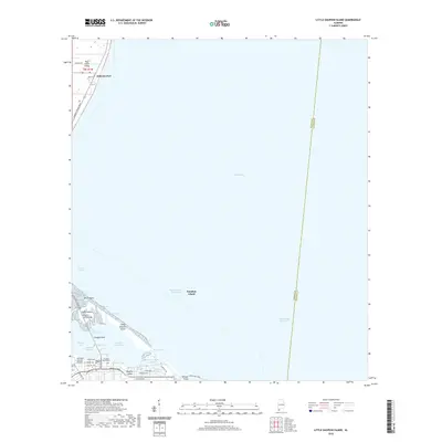
2020 Map of Little Dauphin Island
USGS Topo · Published 2020About this map
Alabama Port and the northern tip of Dauphin Island are connected by the Dauphin Island Bridge, marking a critical juncture between the mainland and the barrier island system. This map highlights the complex maritime geography of the region, where the Intracoastal Waterway and the Mobile Ship Channel facilitate significant waterborne transit through Mobile Bay. The landscape is defined by intricate tidal inlets and bayous, including Hudson Bayou and Pass Chateaugue, which separate the primary landmass from Little Dauphin Island.
Find a feature on this map
49 named features on this map. Tap any name to fly to it.
Don’t see what you’re looking for? This feature index may not catch every label — zoom into the map to look around manually.
Map Details
Editions of this 2020 Little Dauphin Island Map
This is the sole edition of this map. No revisions or reprints were ever made.
Other maps of this area

1921 · Point Clear
USGS Topo · 1:62,500

1921 · Dauphin Island
USGS Topo · 1:62,500

1921 · Delchamps
USGS Topo · 1:62,500

1941 · Cedar Point
USGS Topo · 1:62,500

1941 · Weeks Bay
USGS Topo · 1:62,500

1942 · Fort Morgan
USGS Topo · 1:62,500

1943 · Cedar Point
USGS Topo · 1:62,500

1943 · Weeks Bay
USGS Topo · 1:62,500

1953 · Mobile
USGS Topo · 1:250,000
1956 · Point Clear
USGS Topo · 1:24,000