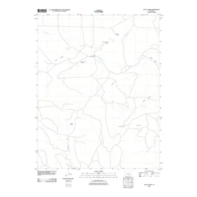
2010 Map of Little Dome
USGS Topo · Published 2010About this map
Tejana Arroyo and a network of ephemeral watercourses define this portion of Las Animas County, where the high desert landscape is punctuated by vital water infrastructure. Evidence of ranching and land management is found at several named water sources, including Jack Williams Dam and two distinct springs, Box Canyon Spring and Tollers Spring. The reliance on local groundwater is further highlighted by several named landmarks like the Cottonwood Tree Windmill, Newman and Bell Windmill, and The Frenchman Windmill. The topography is dominated by the prominent elevation of Little Dome and the broad expanse of Cordova Mesa, cut by deep drainages such as Smith Hollow and Miners Canyon. This survey captures a rural landscape where terrain features and water improvements are the primary markers of human activity.
Find a feature on this map
15 named features on this map. Tap any name to fly to it.
Don’t see what you’re looking for? This feature index may not catch every label — zoom into the map to look around manually.
Map Details
Editions of this 2010 Little Dome Map
This is the sole edition of this map. No revisions or reprints were ever made.
Other maps of this area

1891 · Walsenburg
USGS Topo · 1:125,000

1891 · Spanish Peaks
USGS Topo · 1:125,000

1891 · Apishapa
USGS Topo · 1:125,000

1892 · Elmoro
USGS Topo · 1:125,000

1893 · Spanish Peaks
USGS Topo · 1:125,000

1893 · Apishapa
USGS Topo · 1:125,000

1893 · Elmoro
USGS Topo · 1:125,000

1894 · Walsenburg
USGS Topo · 1:125,000

1895 · Spanish Peaks
USGS Topo · 1:125,000

1897 · Walsenburg
USGS Topo · 1:125,000