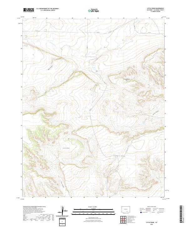
2022 Map of Little Dome
USGS Topo · Published 2022About this map
Little Dome rises as a central topographic landmark in this section of Las Animas County, which is defined by a complex network of arroyos and mesas. The drainage pattern is dominated by Tejana Arroyo in the north and the deep incisions of Jack Canyon and Box Canyon to the southwest, illustrating a landscape shaped by intermittent water flow. Natural water sources like Box Canyon Spring and Tollers Spring punctuate the arid terrain, which was likely critical for local ranching operations. The presence of Cordova Mesa and the Smith Hollow Hills indicates a varied elevation profile typical of this high-plains environment. A sparse grid of county roads, including Co RD 86 and Co RD 77, provides the primary access through these townships, connecting the scattered canyons and hollows that characterize this rural Colorado landscape.
Find a feature on this map
22 named features on this map. Tap any name to fly to it.
Don’t see what you’re looking for? This feature index may not catch every label — zoom into the map to look around manually.
Map Details
Editions of this 2022 Little Dome Map
This is the sole edition of this map. No revisions or reprints were ever made.
Other maps of this area

1891 · Walsenburg
USGS Topo · 1:125,000

1891 · Spanish Peaks
USGS Topo · 1:125,000

1891 · Apishapa
USGS Topo · 1:125,000

1892 · Elmoro
USGS Topo · 1:125,000

1893 · Spanish Peaks
USGS Topo · 1:125,000

1893 · Apishapa
USGS Topo · 1:125,000

1893 · Elmoro
USGS Topo · 1:125,000

1894 · Walsenburg
USGS Topo · 1:125,000

1895 · Spanish Peaks
USGS Topo · 1:125,000

1897 · Walsenburg
USGS Topo · 1:125,000