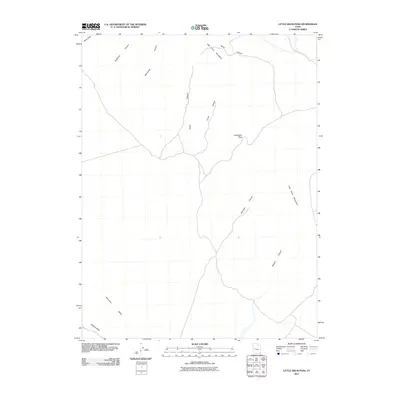
2011 Map of Little Drum Pass
USGS Topo · Published 2011About this map
Little Drum Pass serves as the central crossing point in this arid reach of Millard County, providing a high-elevation transit between the eastern and western slopes of the Little Drum Mountains. The geography is defined by a series of deep drainage channels that cut through the high ground, including Buckhorn Canyon and Monument Canyon to the north, and Dennison Canyon and Whalen Canyon to the south. These seasonal watercourses eventually feed into the broader basin of Whirlwind Valley, where the terrain flattens toward the Swasey Wash. Notable landmarks such as Black Point and the descriptive Corral Canyon and Horse Canyon suggest a landscape historically utilized for livestock movement and navigation through the pass, while the lack of modern settlements highlights the area's isolation and its status as a critical corridor for desert travel.
Find a feature on this map
12 named features on this map. Tap any name to fly to it.
Don’t see what you’re looking for? This feature index may not catch every label — zoom into the map to look around manually.
Map Details
Editions of this 2011 Little Drum Pass Map
This is the sole edition of this map. No revisions or reprints were ever made.
Other maps of this area

1885 · Sevier Desert
USGS Topo · 1:250,000

1908 · Fish Springs
USGS Topo · 1:250,000

1910 · Fish Springs
USGS Topo · 1:250,000

1953 · Topaz Mtn
USGS Topo · 1:62,500

1953 · Delta
USGS Topo · 1:250,000

1958 · Delta
USGS Topo · 1:250,000

1962 · Delta
USGS Topo · 1:250,000

1971 · Clay Knoll
USGS Topo · 1:24,000

1971 · Drum Mts Well
USGS Topo · 1:24,000
1971 · Smelter Knolls West
USGS Topo · 1:24,000