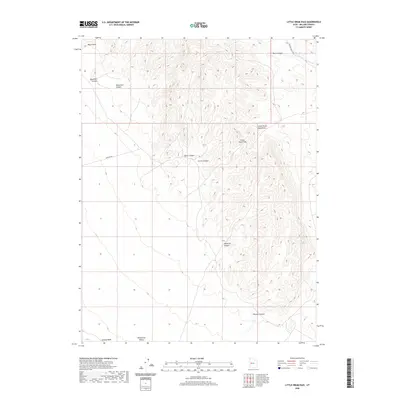
2020 Map of Little Drum Pass
USGS Topo · Published 2020About this map
Little Drum Pass serves as a central landmark in this arid portion of Millard County, providing a natural crossing through the Little Drum Mountains. The terrain is defined by a series of deep drainages including Horse Canyon, Dennison Canyon, and Buckhorn Canyon, which funnel toward the broad expanse of Whirlwind Valley to the south. This 2020 survey illustrates the remote character of the Great Basin landscape, where infrastructure is limited to primitive routes like Drum Mt Rd and Smelter Knoll Rd. These tracks connect isolated geographical points such as Black Point and Monument Canyon, reflecting a region primarily utilized for rangeland and geological transit rather than permanent settlement. The placement of Swasey Wash and Whalen Canyon further details the intricate watershed patterns that dominate this high-desert environment.
Find a feature on this map
15 named features on this map. Tap any name to fly to it.
Don’t see what you’re looking for? This feature index may not catch every label — zoom into the map to look around manually.
Map Details
Editions of this 2020 Little Drum Pass Map
This is the sole edition of this map. No revisions or reprints were ever made.
Other maps of this area

1885 · Sevier Desert
USGS Topo · 1:250,000

1908 · Fish Springs
USGS Topo · 1:250,000

1910 · Fish Springs
USGS Topo · 1:250,000

1953 · Topaz Mtn
USGS Topo · 1:62,500

1953 · Delta
USGS Topo · 1:250,000

1958 · Delta
USGS Topo · 1:250,000

1962 · Delta
USGS Topo · 1:250,000

1971 · Clay Knoll
USGS Topo · 1:24,000

1971 · Drum Mts Well
USGS Topo · 1:24,000
1971 · Smelter Knolls West
USGS Topo · 1:24,000