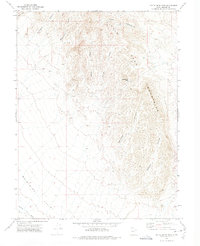
1972 Map of Little Drum Pass
USGS Topo · Published 1974About this map
The Little Drum Mountains dominate this high-desert landscape in central Utah, serving as a prominent geographical barrier between basins. This 1972 survey records a network of deep drainage systems, including Buckhorn Canyon, Monument Canyon, and Dennison Canyon, which carve through the uplifted terrain. A notable geographic bottleneck, Little Drum Pass, provides a point of transit through the range, connecting the higher elevations to the broad expanse of the Whirlwind Valley to the southwest. The presence of a Jeep Trail winding through the center of the sheet indicates the limited, specialized access to this arid region. To the northwest, Black Point stands as a distinct landmark overlooking the rugged topography. The map also captures the lower drainage of Swasey Wash, illustrating how seasonal water flow shapes the alluvial fans at the mountain base.
Find a feature on this map
13 named features on this map. Tap any name to fly to it.
Don’t see what you’re looking for? This feature index may not catch every label — zoom into the map to look around manually.
Map Details
Editions of this 1972 Little Drum Pass Map
This is the sole edition of this map. No revisions or reprints were ever made.
Other maps of this area

1885 · Sevier Desert
USGS Topo · 1:250,000

1908 · Fish Springs
USGS Topo · 1:250,000

1910 · Fish Springs
USGS Topo · 1:250,000

1953 · Topaz Mtn
USGS Topo · 1:62,500

1953 · Delta
USGS Topo · 1:250,000

1958 · Delta
USGS Topo · 1:250,000

1962 · Delta
USGS Topo · 1:250,000

1971 · Clay Knoll
USGS Topo · 1:24,000

1971 · Drum Mts Well
USGS Topo · 1:24,000
1971 · Smelter Knolls West
USGS Topo · 1:24,000