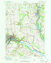
1943 Map of Little Falls
USGS Topo · Published 1972About this map
Little Falls serves as a critical industrial and transit hub during the early 1940s, where the Mohawk River and the Erie Canal carve through a narrow gap in the Mohawk Valley. The city's dense grid is flanked by the New York Central railroad, illustrating the intense concentration of mid-century transport infrastructure. Nearby, the presence of an Airway Beacon on the heights south of the river signals the evolving landscape of early aviation alongside traditional rail and water routes.
Find a feature on this map
54 named features on this map. Tap any name to fly to it.
Don’t see what you’re looking for? This feature index may not catch every label — zoom into the map to look around manually.
Map Details
Editions of this 1943 Little Falls Map
2 editions found
Other maps of this area

1898 · Canajoharie
USGS Topo · 1:62,500

1900 · Little Falls
USGS Topo · 1:62,500

1900 · Canajoharie
USGS Topo · 1:62,500

1901 · Lassellsville
USGS Topo · 1:62,500

1902 · Canajoharie
USGS Topo · 1:62,500

1903 · Richfield Springs
USGS Topo · 1:62,500

1903 · Lassellsville
USGS Topo · 1:62,500

1903 · Little Falls
USGS Topo · 1:62,500

1939 · Little Falls
USGS Topo · 1:62,500

1943 · Jordanville
USGS Topo · 1:24,000