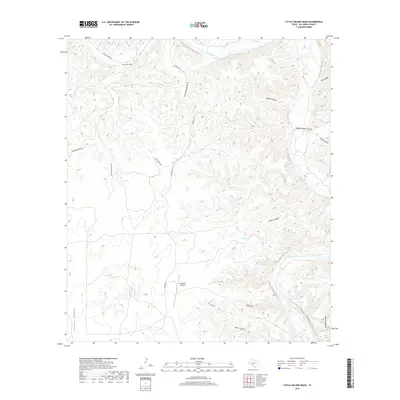
2019 Map of Little Fielder Draw
USGS Topo · Published 2019About this map
The Pecos River carves a deep, winding path through the limestone-cut landscape of western Texas, forming the primary geographic anchor for this part of Val Verde County. The terrain is defined by an intricate network of drainage systems, where significant features like Big Fielder Draw and Little Fielder Draw funnel toward the river basin. These canyons and draws often carry the names of local families and historical landmarks, such as Wagon Canyon, Oppenheimer Canyon, and Harkell Canyon, reflecting the ranching heritage of the region.
Find a feature on this map
24 named features on this map. Tap any name to fly to it.
Don’t see what you’re looking for? This feature index may not catch every label — zoom into the map to look around manually.
Map Details
Editions of this 2019 Little Fielder Draw Map
This is the sole edition of this map. No revisions or reprints were ever made.
Other maps of this area

1943 · Langtry
USGS Topo · 1:62,500

1943 · Shumla
USGS Topo · 1:62,500

1954 · Sonora
USGS Topo · 1:250,000

1958 · Sonora
USGS Topo · 1:250,000

1958 · Del Rio
USGS Topo · 1:250,000

1964 · Del Rio
USGS Topo · 1:250,000

1970 · Everett Canyon
USGS Topo · 1:24,000

1970 · Pandale
USGS Topo · 1:24,000

1970 · Little Fielder Draw
USGS Topo · 1:24,000
1970 · Divide Well Draw
USGS Topo · 1:24,000