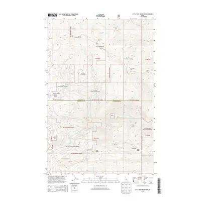
2013 Map of Little Goat Mountains
USGS Topo · Published 2013About this map
St Joe National Forest and Clearwater National Forest meet at the Shoshone and Clearwater county line, defining a landscape dominated by the high peaks of the Little Goat Mountains. This 2013 survey illustrates a region largely shaped by forest management and aviation accessibility, with the Stocking Meadows Airport and Stocking Meadows providing a clear landing point amidst the drainage of the Little North Fork Clearwater River. The map details a network of named natural landmarks and remote improvements like the Blue Heaven Cabin near Blackdome Peak. Numerous saddles and rocks, including Dennis Saddle, Finns Saddle, and Bohns Rock, provide navigation points along the ridges. Waterways such as Big Talk Lake and Foehl Creek flow through the deep drainages, while named features like Clugs Jumpoff and Cobblers Knob indicate the steep, varied elevations that characterize this part of the Idaho panhandle.
Find a feature on this map
44 named features on this map. Tap any name to fly to it.
Don’t see what you’re looking for? This feature index may not catch every label — zoom into the map to look around manually.
Map Details
Editions of this 2013 Little Goat Mountains Map
This is the sole edition of this map. No revisions or reprints were ever made.
Other maps of this area

1914 · Avery
USGS Topo · 1:125,000

1917 · Avery
USGS Topo · 1:125,000

1923 · Washington Creek
USGS Topo · 1:125,000

1936 · Boehls Butte
USGS Topo · 1:48,000

1943 · Boehls Butte
USGS Topo · 1:62,500

1956 · Wallace
USGS Topo · 1:250,000

1956 · Hamilton
USGS Topo · 1:250,000

1959 · Hamilton
USGS Topo · 1:250,000

1960 · Wallace
USGS Topo · 1:250,000

1960 · Hamilton
USGS Topo · 1:250,000