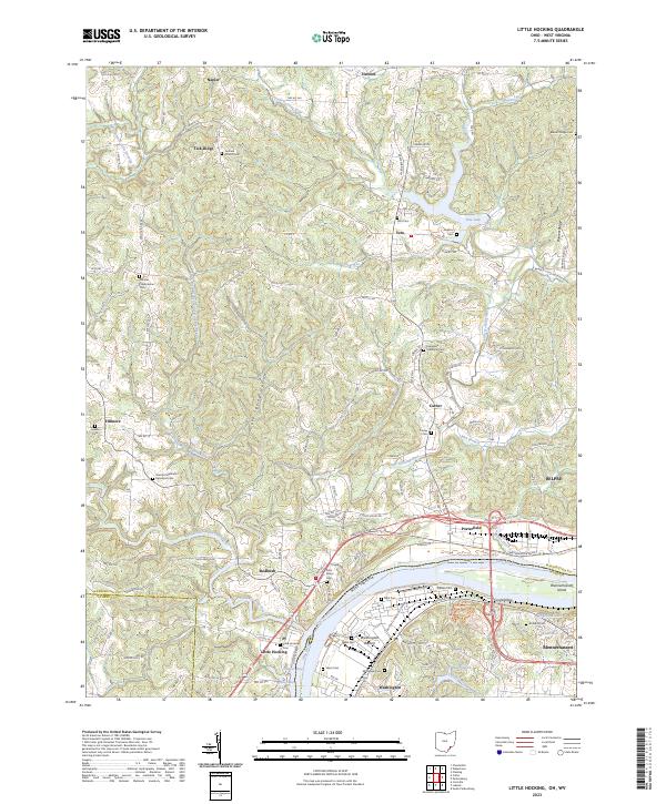
2023 Map of Little Hocking
USGS Topo · Published 2023About this map
The Ohio River forms the southern boundary of this region, where the broad agricultural flats of Washington Bottom sit across from the significant historical landmark of Blennerhassett Island. The landscape is defined by the winding course of the Little Hocking River and its various tributaries, such as Plum Run and Longs Run, which carve through the terrain toward the river valley. The map reveals a dense network of early settlements and rural centers including Little Hocking, Porterfield, and Veto, the latter featuring Veto Lake. Genealogists will find a wealth of burial sites recorded here, from the Fairfield Church Cem and Decatur Presbyterian Cem in the uplands to the Saint Marys Cem and Neal Cem nearer the water. The presence of the Quaker Cem near Fillmore and the Decatur Methodist Episcopal Cem further illustrates the established religious and community roots of the local population.
Find a feature on this map
179 named features on this map. Tap any name to fly to it.
Don’t see what you’re looking for? This feature index may not catch every label — zoom into the map to look around manually.
Map Details
Editions of this 2023 Little Hocking Map
This is the sole edition of this map. No revisions or reprints were ever made.
Other maps of this area

1902 · Parkersburg
USGS Topo · 1:62,500

1904 · Parkersburg
USGS Topo · 1:62,500

1904 · Chesterhill
USGS Topo · 1:62,500

1906 · Belleville
USGS Topo · 1:62,500

1906 · Chesterhill
USGS Topo · 1:62,500

1907 · Keno
USGS Topo · 1:62,500

1924 · Belleville
USGS Topo · 1:62,500

1926 · Belleville
USGS Topo · 1:62,500

1949 · Clarksburg
USGS Topo · 1:250,000

1956 · Clarksburg
USGS Topo · 1:250,000