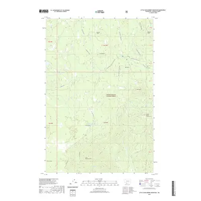
2020 Map of Little Huckleberry Mountain
USGS Topo · Published 2020About this map
Gifford Pinchot National Forest dominates this section of the Cascades, where seasonal trails and volcanic geology define the landscape. High peaks such as Little Huckleberry Mtn and Peterson Butte provide the topographical backbone for a network of winter recreation routes, including the 6020 Sled and the Berryfield Sm Loop. The map documents a complex system of drainage and small water bodies, from South Prairie Lake near South Prairie to the cluster of Forlorn Lakes in the northwest. To the southeast, the terrain transitions into the distinct geological features of the Big Lava Bed, while the Monte Cristo Range rises along the eastern boundary. The presence of specialized tracks like the Natural Bridges Xc Loop and Ice Caves Xc Loop highlights the area's significance as a hub for snow-based navigation and high-elevation exploration.
Find a feature on this map
31 named features on this map. Tap any name to fly to it.
Don’t see what you’re looking for? This feature index may not catch every label — zoom into the map to look around manually.
Map Details
Editions of this 2020 Little Huckleberry Mountain Map
This is the sole edition of this map. No revisions or reprints were ever made.
Other maps of this area

1926 · Steamboat Mtn
USGS Topo · 1:125,000

1926 · Hood River
USGS Topo · 1:125,000

1929 · Hood River
USGS Topo · 1:125,000

1931 · Steamboat Mtn
USGS Topo · 1:125,000

1950 · Yakima
USGS Topo · 1:250,000

1953 · The Dalles
USGS Topo · 1:250,000

1956 · The Dalles
USGS Topo · 1:250,000

1957 · The Dalles
USGS Topo · 1:250,000

1957 · Wind River
USGS Topo · 1:62,500

1957 · Willard
USGS Topo · 1:62,500