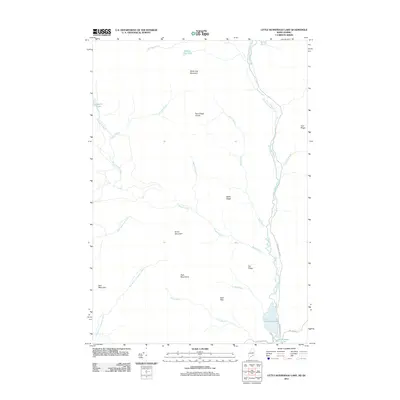
2011 Map of Little Kennebago Lake
USGS Topo · Published 2011About this map
Little Kennebago Lake and the northern reaches of Kennebago Lake anchor this 2011 survey of the Maine-Quebec borderlands. The landscape is defined by its complex drainage network, where the Kennebago River and its tributaries, such as the Crowley Branch and Bear Brook, carve through high terrain. Prominent summits including White Cap Mountain, Snow Mountain, and the Twin Mountains provide a backdrop to a wilderness marked by numerous isolated water bodies like Secret Pond and Cupsuptic Pond. The primitive road network, including Kennebago River Rd and Tim Pond Rd, suggests an area primarily used for timber management or remote recreation. Distinctive landmarks such as Bald Pate and the Kennebago Divide highlight the physical challenges of this border region, where the East Branch Cupsuptic River and Wiggle Brook flow through an environment largely untouched by dense settlement.
Find a feature on this map
29 named features on this map. Tap any name to fly to it.
Don’t see what you’re looking for? This feature index may not catch every label — zoom into the map to look around manually.
Map Details
Editions of this 2011 Little Kennebago Lake Map
This is the sole edition of this map. No revisions or reprints were ever made.
Other maps of this area

1928 · Chain Lakes
USGS Topo · 1:48,000

1931 · Cupsuptic
USGS Topo · 1:48,000

1932 · Kennebago Lake
USGS Topo · 1:48,000

1932 · Arnold Pond
USGS Topo · 1:48,000

1932 · Chain Lakes
USGS Topo · 1:62,500

1934 · Cupsuptic
USGS Topo · 1:62,500

1935 · Kennebago Lake
USGS Topo · 1:62,500

1935 · Chain Lakes
USGS Topo · 1:62,500

1935 · Cupsuptic
USGS Topo · 1:62,500

1935 · Arnold Pond
USGS Topo · 1:62,500