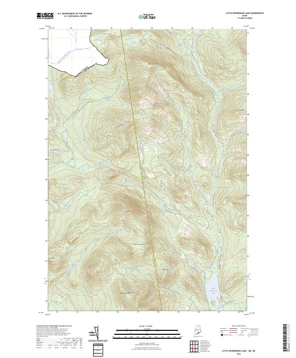
2024 Map of Little Kennebago Lake
USGS Topo · Published 2024About this map
Little Kennebago Lake and the winding Kennebago River anchor this highland region along the Oxford and Franklin County line. The landscape is defined by its complex drainage network, where the East Branch-Cupsuptic River, Wiggle Brook, and Otter Brook carve through a series of high ridges and summits. Notable elevations include West Kennebago Mtn, Snow Mtn, and the Twin Mountains, which form part of the Kennebago Divide. The northern edge of the sheet reaches the international border between Canada and the United States of America near Dennison Bog. A network of unpaved routes such as the Beaver Pond Tote Rd and Cupsuptic Tote Rd provides the primary access through this timber-rich environment, connecting various mountain passes and remote water bodies like White Cap Pond.
Find a feature on this map
36 named features on this map. Tap any name to fly to it.
Don’t see what you’re looking for? This feature index may not catch every label — zoom into the map to look around manually.
Map Details
Editions of this 2024 Little Kennebago Lake Map
This is the sole edition of this map. No revisions or reprints were ever made.
Other maps of this area

1928 · Chain Lakes
USGS Topo · 1:48,000

1931 · Cupsuptic
USGS Topo · 1:48,000

1932 · Kennebago Lake
USGS Topo · 1:48,000

1932 · Arnold Pond
USGS Topo · 1:48,000

1932 · Chain Lakes
USGS Topo · 1:62,500

1934 · Cupsuptic
USGS Topo · 1:62,500

1935 · Kennebago Lake
USGS Topo · 1:62,500

1935 · Chain Lakes
USGS Topo · 1:62,500

1935 · Cupsuptic
USGS Topo · 1:62,500

1935 · Arnold Pond
USGS Topo · 1:62,500