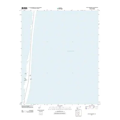
2011 Map of Little Kinnakeet
USGS Topo · Published 2011About this map
Hatteras Island dominates this slender coastal survey, showcasing the fragile geography of the Outer Banks where the narrow landmass separates the Atlantic Ocean from the sound. The settlement of Little Kinnakeet is situated along the sound side of the island, a location defined by the maritime environment of Terrapin Point and the nearby Drain Islands. The map illustrates a landscape of extreme exposure, with Bald Beach facing the open sea. This 2011 digital survey reflects the modern shoreline of Dare County, providing a precise record of the barrier island's configuration before significant storm-driven shifts. The concentration of structures and named points along the western edge highlights the historical preference for sound-side development, protected from the direct Atlantic surf.
Find a feature on this map
6 named features on this map. Tap any name to fly to it.
Don’t see what you’re looking for? This feature index may not catch every label — zoom into the map to look around manually.
Map Details
Editions of this 2011 Little Kinnakeet Map
This is the sole edition of this map. No revisions or reprints were ever made.
Other maps of this area

1943 · Roanoke Island
USGS Topo · 1:125,000

1948 · Buxton
USGS Topo · 1:24,000

1950 · Buxton
USGS Topo · 1:24,000

1955 · Wanchese
USGS Topo · 1:250,000

1957 · Manteo
USGS Topo · 1:250,000

1960 · Manteo
USGS Topo · 1:250,000

1985 · Cape Hatteras
USGS Topo · 1:100,000

1985 · Manteo
USGS Topo · 1:100,000

2011 · Buxton
USGS Topo · 1:24,000
2011 · Gull Island
USGS Topo · 1:24,000