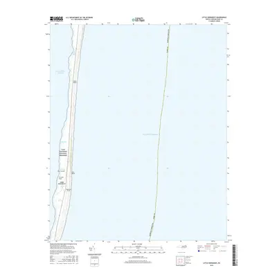
2016 Map of Little Kinnakeet
USGS Topo · Published 2016About this map
Hatteras Island forms a narrow barrier between the Atlantic Ocean and the sound-side waters in this modern survey of the North Carolina coast. The landscape is dominated by the Cape Hatteras National Seashore, preserving the delicate environment of the Outer Banks. Near the center of this coastal strip, Little Kinnakeet sits as a notable point of interest, flanked by marshy inlets and small islands. The sound side of the island is highly articulated with features such as Gull Island Bay, Phipps Cove, and the Drain Islands. The mapping reflects the dynamic nature of these coastal boundaries, where names like The Drain and Bog Opening suggest the shifting water and marsh patterns of the Dare County shoreline.
Find a feature on this map
15 named features on this map. Tap any name to fly to it.
Don’t see what you’re looking for? This feature index may not catch every label — zoom into the map to look around manually.
Map Details
Editions of this 2016 Little Kinnakeet Map
This is the sole edition of this map. No revisions or reprints were ever made.
Other maps of this area

1943 · Roanoke Island
USGS Topo · 1:125,000

1948 · Buxton
USGS Topo · 1:24,000

1950 · Buxton
USGS Topo · 1:24,000

1955 · Wanchese
USGS Topo · 1:250,000

1957 · Manteo
USGS Topo · 1:250,000

1960 · Manteo
USGS Topo · 1:250,000

1985 · Cape Hatteras
USGS Topo · 1:100,000

1985 · Manteo
USGS Topo · 1:100,000

2011 · Buxton
USGS Topo · 1:24,000
2011 · Gull Island
USGS Topo · 1:24,000