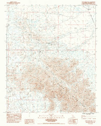
1983 Map of Little Maria Mts
USGS Topo · Published 1983About this map
The Little Maria Mountains dominate this 1980s landscape in Riverside County, revealing a terrain defined by arid hydrology and early resource extraction. Water sources are scarce, marked primarily by Tank Spring and the notably inactive Browns Well (Dry). The survey highlights the network of Dry Wash channels that cut through the topography, illustrating the drainage patterns of this desert environment. Human activity is evidenced by scattered industrial sites, including several Prospect points and a Mine, which suggest the area's history of mineral exploration. Transport through this portion of the Mojave is limited to the established Midland Road and several rugged paths labeled as Jeep Trail, which provide access to the interior of the range.
Find a feature on this map
10 named features on this map. Tap any name to fly to it.
Don’t see what you’re looking for? This feature index may not catch every label — zoom into the map to look around manually.
Map Details
Editions of this 1983 Little Maria Mts Map
2 editions found
Other maps of this area

1942 · Blythe
USGS Topo · 1:250,000

1942 · Amboy
USGS Topo · 1:250,000

1943 · Amboy
USGS Topo · 1:250,000

1943 · Iron Mountains
USGS Topo · 1:62,500

1945 · Midland
USGS Topo · 1:62,500

1952 · Midland
USGS Topo · 1:62,500

1952 · Palen Mountains
USGS Topo · 1:62,500

1954 · Salton Sea
USGS Topo · 1:250,000

1954 · Needles
USGS Topo · 1:250,000

1954 · Rice
USGS Topo · 1:62,500