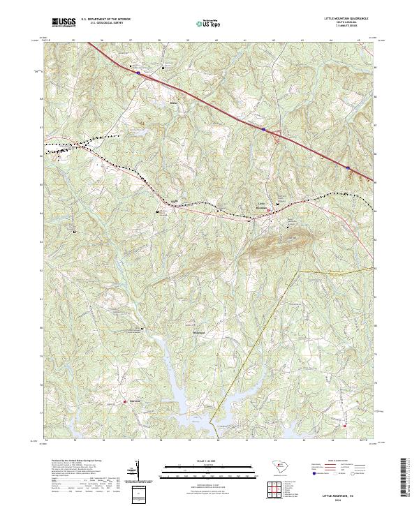
2024 Map of Little Mountain
USGS Topo · Published 2024About this map
Little Mountain stands as a prominent landmark in the north, anchoring a rural South Carolina landscape where Newberry Co meets Lexington Co. This area is characterized by a high concentration of institutional history, evidenced by numerous community-centered hubs like Holy Trinity Church and Mount Tabor Church, each with its own established Graveyard. The southern portion of the map is dominated by the sprawling northern reaches of Lake Murray, where the terrain transitions from rolling woodlands to a complex shoreline fed by Camping Creek and Buffalo Creek. This topography influenced the development of small settlements like Wheeland and Fairview that lie near the water's edge. Traces of older educational networks remain visible through labels like Central School Rd, while the transport corridor of Kibler Bridge Rd and the Interstate route provide modern connectivity through the historical communities of Kibler and Slighs.
Find a feature on this map
144 named features on this map. Tap any name to fly to it.
Don’t see what you’re looking for? This feature index may not catch every label — zoom into the map to look around manually.
Map Details
Editions of this 2024 Little Mountain Map
This is the sole edition of this map. No revisions or reprints were ever made.
Other maps of this area

1904 · Columbia
USGS Topo · 1:125,000

1941 · Spartanburg
USGS Topo · 1:250,000

1953 · Spartanburg
USGS Topo · 1:250,000

1960 · Spartanburg
USGS Topo · 1:250,000

1963 · Spartanburg
USGS Topo · 1:250,000

1964 · Spartanburg
USGS Topo · 1:250,000

1968 · Newberry East
USGS Topo · 1:24,000

1969 · Pomaria
USGS Topo · 1:24,000
1969 · Jenkinsville
USGS Topo · 1:24,000
1970 · Prosperity
USGS Topo · 1:24,000