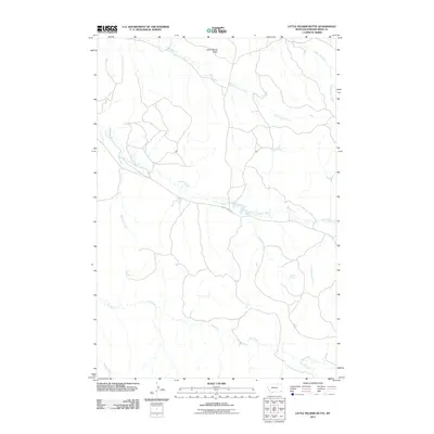
2011 Map of Little Pilgrim Butte
USGS Topo · Published 2011About this map
Little Pilgrim Butte dominates this corner of the Powder River Basin, standing as a prominent landmark above an intricate network of drainage systems. The landscape is defined by the convergence of several significant watercourses, including the north-trending Little Pilgrim Creek and Sage Hen Creek, which slice through the high plains. The presence of Edwards Spring suggests a critical water source in an otherwise arid environment, supporting the early ranching and stock-raising history of the region.
Find a feature on this map
12 named features on this map. Tap any name to fly to it.
Don’t see what you’re looking for? This feature index may not catch every label — zoom into the map to look around manually.
Map Details
Editions of this 2011 Little Pilgrim Butte Map
This is the sole edition of this map. No revisions or reprints were ever made.
Other maps of this area

1954 · Ekalaka
USGS Topo · 1:250,000

1956 · Ekalaka
USGS Topo · 1:250,000

1958 · Ekalaka
USGS Topo · 1:250,000

1965 · Ekalaka
USGS Topo · 1:250,000

1973 · Monday Creek
USGS Topo · 1:24,000

1973 · Hawkey Creek
USGS Topo · 1:24,000
1973 · Fighting Butte
USGS Topo · 1:24,000

1979 · Deer Creek Buttes
USGS Topo · 1:24,000

1979 · McKenzie Creek
USGS Topo · 1:24,000

1980 · Broadus
USGS Topo · 1:100,000