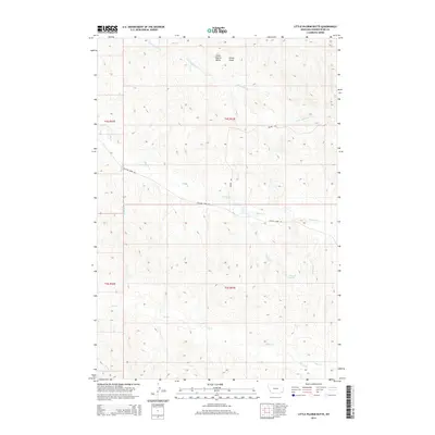
2014 Map of Little Pilgrim Butte
USGS Topo · Published 2014About this map
Little Pilgrim Butte serves as a prominent landmark in this section of Powder River County, overseeing a landscape defined by an intricate network of drainage basins and creek beds. The area is dominated by the seasonal flows of Little Pilgrim Cr and Pilgrim Cr, which have carved deep paths through the high plains. Evidence of early water management and stock raising is visible at Edwards Spring, a vital resource in this semi-arid environment. The road network is sparse, consisting primarily of Moore Rd and Pilgram Creek Rd, which follow the natural contours of the land. Other named drainages like Strock Draw, Sage Hen Cr, and Jim Drake Cr emphasize the importance of water and terrain in the organization of this territory within the Public Land Survey System.
Find a feature on this map
18 named features on this map. Tap any name to fly to it.
Don’t see what you’re looking for? This feature index may not catch every label — zoom into the map to look around manually.
Map Details
Editions of this 2014 Little Pilgrim Butte Map
This is the sole edition of this map. No revisions or reprints were ever made.
Other maps of this area

1954 · Ekalaka
USGS Topo · 1:250,000

1956 · Ekalaka
USGS Topo · 1:250,000

1958 · Ekalaka
USGS Topo · 1:250,000

1965 · Ekalaka
USGS Topo · 1:250,000

1973 · Monday Creek
USGS Topo · 1:24,000

1973 · Hawkey Creek
USGS Topo · 1:24,000
1973 · Fighting Butte
USGS Topo · 1:24,000

1979 · Deer Creek Buttes
USGS Topo · 1:24,000

1979 · McKenzie Creek
USGS Topo · 1:24,000

1980 · Broadus
USGS Topo · 1:100,000