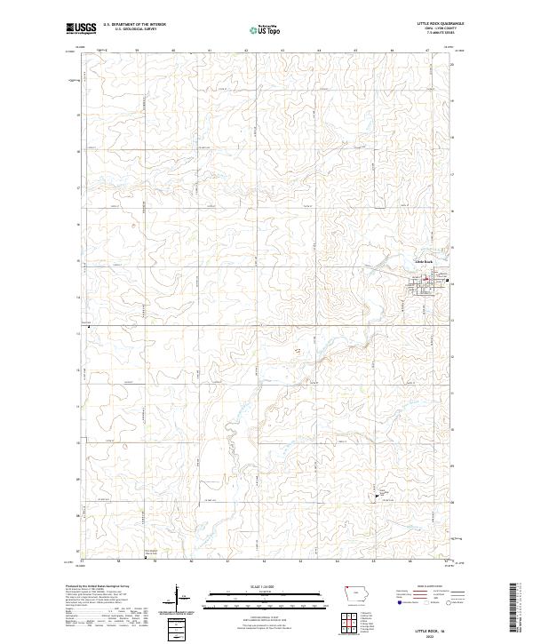
2022 Map of Little Rock
USGS Topo · Published 2022About this map
Little Rock occupies the eastern portion of this Lyon County landscape, where the local street grid intersects near the Little Rock River. The town's layout is defined by thoroughfares such as Main St and Section Line Ave, serving as a central hub for the surrounding agricultural sections. The survey reveals a high density of rural burial sites and landmarks of local importance, including Pleasant View Cem situated near the town limits and Grant Township Cem further south. The drainage pattern is dictated by the winding path of the river and several tributaries like Tom Cr and Whitney Cr, while the presence of Argo Slough indicates low-lying areas in the river valley. The landscape is meticulously organized into township and range blocks, illustrating the enduring influence of the Public Land Survey System on Iowa's western frontier.
Find a feature on this map
42 named features on this map. Tap any name to fly to it.
Don’t see what you’re looking for? This feature index may not catch every label — zoom into the map to look around manually.
Map Details
Editions of this 2022 Little Rock Map
This is the sole edition of this map. No revisions or reprints were ever made.
Other maps of this area

1954 · Fairmont
USGS Topo · 1:250,000

1955 · Sioux Falls
USGS Topo · 1:250,000

1958 · Sioux Falls
USGS Topo · 1:250,000

1958 · Fairmont
USGS Topo · 1:250,000

1967 · Rushmore
USGS Topo · 1:24,000

1967 · Adrian SW
USGS Topo · 1:24,000

1967 · Ellsworth
USGS Topo · 1:24,000

1971 · Edna
USGS Topo · 1:24,000

1971 · George West
USGS Topo · 1:24,000

1972 · Ashton
USGS Topo · 1:24,000