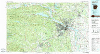
1985 Map of Little Rock
USGS Topo · Published 1988About this map
Little Rock and North Little Rock occupy the central stage of this mid-1980s landscape, where the Arkansas River serves as the dividing line between the urban center and the rising foothills to the west. The capital city's institutional footprint is deeply documented, from the State Capitol and Governor's Mansion to specialized facilities like the State School for the Blind and the University of Arkansas Medical Center. To the southwest, the industrial heritage of Bauxite is evidenced by the extensive Bauxite Mines and the Bauxite Cem, reflecting the importance of aluminum ore to the regional economy.
Find a feature on this map
276 named features on this map. Tap any name to fly to it.
Don’t see what you’re looking for? This feature index may not catch every label — zoom into the map to look around manually.
Map Details
Editions of this 1985 Little Rock Map
This is the sole edition of this map. No revisions or reprints were ever made.
Other maps of this area

1888 · Dardanelle #4
USGS Topo · 1:62,500

1889 · Morrilton No. 3
USGS Topo · 1:62,500

1890 · Benton
USGS Topo · 1:125,000

1890 · Hot Springs
USGS Topo · 1:125,000

1890 · Dardanelle
USGS Topo · 1:125,000

1891 · Little Rock
USGS Topo · 1:125,000

1892 · Morrillton
USGS Topo · 1:125,000

1893 · Little Rock
USGS Topo · 1:125,000

1894 · Morrillton
USGS Topo · 1:125,000

1894 · Hot Springs
USGS Topo · 1:125,000