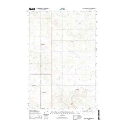
2014 Map of Little Sheep Mountain
USGS Topo · Published 2014About this map
Little Sheep Mtn rises above a landscape defined by an intricate network of drainage systems in this section of Prairie County. The topography is deeply incised by Cherry Cr and its various tributaries, including the N Fork Cherry Cr and S Fork Cherry Cr. These watercourses create a dissected terrain that dictated the placement of early transportation routes, such as Cherry Creek Rd and Caprock Rd, which skirt the higher elevations and follow the natural contours of the land.
Find a feature on this map
14 named features on this map. Tap any name to fly to it.
Don’t see what you’re looking for? This feature index may not catch every label — zoom into the map to look around manually.
Map Details
Editions of this 2014 Little Sheep Mountain Map
This is the sole edition of this map. No revisions or reprints were ever made.
Other maps of this area

1953 · Miles City
USGS Topo · 1:250,000

1954 · Glendive
USGS Topo · 1:250,000

1957 · Miles City
USGS Topo · 1:250,000

1957 · Glendive
USGS Topo · 1:250,000

1958 · Miles City
USGS Topo · 1:250,000

1958 · Glendive
USGS Topo · 1:250,000

1965 · Little Sheep Mountain
USGS Topo · 1:24,000

1965 · Heitz School
USGS Topo · 1:24,000

1965 · Twin Buttes School
USGS Topo · 1:24,000
1965 · Combs Ranch
USGS Topo · 1:24,000