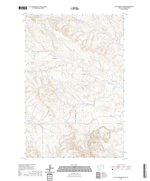
2024 Map of Little Sheep Mountain
USGS Topo · Published 2024About this map
Little Sheep Mtn rises above a complex drainage system in the heart of Prairie County, where the landscape is defined by the convergence of numerous seasonal and perennial waterways. This modern survey illustrates the intricate network of the Cherry Creek watershed, including the North Fork Cherry Creek, South Fork Cherry Creek, and Robertson Creek. The terrain is marked by distinct topographical ridges and draws that reveal the hydrological patterns of the northern Great Plains. Settlement is sparse, with the map primarily documenting the infrastructure of rural travel through labels like N Cherry Creek Rd and Caprock Rd. These corridors follow the natural contours of the land, connecting remote sections of the township grid such as t14n r47e and t13n r46e.
Find a feature on this map
16 named features on this map. Tap any name to fly to it.
Don’t see what you’re looking for? This feature index may not catch every label — zoom into the map to look around manually.
Map Details
Editions of this 2024 Little Sheep Mountain Map
This is the sole edition of this map. No revisions or reprints were ever made.
Other maps of this area

1953 · Miles City
USGS Topo · 1:250,000

1954 · Glendive
USGS Topo · 1:250,000

1957 · Miles City
USGS Topo · 1:250,000

1957 · Glendive
USGS Topo · 1:250,000

1958 · Miles City
USGS Topo · 1:250,000

1958 · Glendive
USGS Topo · 1:250,000

1965 · Little Sheep Mountain
USGS Topo · 1:24,000

1965 · Heitz School
USGS Topo · 1:24,000

1965 · Twin Buttes School
USGS Topo · 1:24,000
1965 · Combs Ranch
USGS Topo · 1:24,000