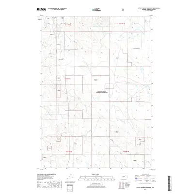
2017 Map of Little Thunder Reservoir
USGS Topo · Published 2017About this map
Wright anchors the northwestern corner of this Campbell County survey, where the town grid meets the vast expanse of the Thunder Basin National Grassland. The landscape is defined by the complex drainage systems of the Powder River Basin, featuring the Little Thunder Creek and its many tributaries, including Dry Fork Little Thunder Creek and Cripple Creek. The map documents a rugged terrain marked by prominent landmarks such as Black Butte and Gray Butte, while the Little Thunder Reservoir provides a critical water source in this arid high plains environment.
Find a feature on this map
34 named features on this map. Tap any name to fly to it.
Don’t see what you’re looking for? This feature index may not catch every label — zoom into the map to look around manually.
Map Details
Editions of this 2017 Little Thunder Reservoir Map
This is the sole edition of this map. No revisions or reprints were ever made.
Other maps of this area

1955 · Newcastle
USGS Topo · 1:250,000

1958 · Newcastle
USGS Topo · 1:250,000

1959 · North Star School
USGS Topo · 1:62,500

1960 · Turnercrest
USGS Topo · 1:62,500

1971 · Teckla
USGS Topo · 1:24,000

1971 · Reno Junction
USGS Topo · 1:24,000

1971 · Reno Reservoir
USGS Topo · 1:24,000

1971 · Little Thunder Reservoir
USGS Topo · 1:24,000

1971 · Teckla SW
USGS Topo · 1:24,000
1971 · Hilight
USGS Topo · 1:24,000