
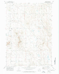
1971 Map of Reno Reservoir
USGS Topo · Published 1974About this map
The Hilight Oil and Gas Field dominates this early 1970s landscape in Campbell County, showing a complex industrial infrastructure of wells, pipelines, and pumping stations. A network of energy production facilities, including the Gopher Pumping Sta and various unnamed oil wells, is mapped alongside the natural drainage systems of the region. The map highlights the intersection of this heavy industry with the local topography, where ephemeral waterways like North Prong Little Thunder Creek and Little Thunder Creek wind through the high plains terrain. Significant local landmarks such as the Reno Reservoir provide water management in an area also marked by Burning Coal Draw and Trussler Draw. Transportation is primarily facilitated by the Reno County Road and Piney Canyon Road, which serve the remote industrial sites scattered throughout the quadrangle.
Find a feature on this map
14 named features on this map. Tap any name to fly to it.
Don’t see what you’re looking for? This feature index may not catch every label — zoom into the map to look around manually.
Map Details
Editions of this 1971 Reno Reservoir Map
This is the sole edition of this map. No revisions or reprints were ever made.
Other maps of this area

1955 · Newcastle
USGS Topo · 1:250,000

1958 · Newcastle
USGS Topo · 1:250,000

1971 · Teckla
USGS Topo · 1:24,000

1971 · Open A Ranch
USGS Topo · 1:24,000

1971 · Reno Junction
USGS Topo · 1:24,000

1971 · Piney Canyon SW
USGS Topo · 1:24,000

1971 · Piney Canyon NW
USGS Topo · 1:24,000

1971 · Little Thunder Reservoir
USGS Topo · 1:24,000

1971 · Teckla SW
USGS Topo · 1:24,000
1971 · Hilight
USGS Topo · 1:24,000