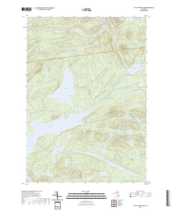
2023 Map of Little Tupper Lake
USGS Topo · Published 2023About this map
Little Tupper Lake and Round Lake dominate this portion of the Adirondack Park at the border of Hamilton, Franklin, and St. Lawrence Counties. The landscape is defined by its complex hydrography, featuring isolated water bodies like Antediluvian Pond, Doctors Pond, and the interconnected Upper Cat Pond, Middle Cat Pond, and Lower Cat Pond. This modern survey illustrates a wilderness preserved for recreation, where traditional routes such as the Canoe Carry Trl and Stony Pond Trl provide access through the dense topography. High points like Cat Mountain and Buck Mountain overlook the Bog River drainage, while the presence of State Rte 421 near Goodman Mountain provides one of the few vehicular access points into this interior lake country. The map serves as a contemporary record of the Adirondack Park Preserve, showing the network of footpaths and logging-era roads that continue to define northern New York's recreational geography.
Find a feature on this map
52 named features on this map. Tap any name to fly to it.
Don’t see what you’re looking for? This feature index may not catch every label — zoom into the map to look around manually.
Map Details
Editions of this 2023 Little Tupper Lake Map
This is the sole edition of this map. No revisions or reprints were ever made.
Other maps of this area

1903 · Raquette Lake
USGS Topo · 1:62,500

1903 · Blue Mountain
USGS Topo · 1:62,500

1904 · Long Lake
USGS Topo · 1:62,500

1907 · Tupper Lake
USGS Topo · 1:62,500

1948 · Ogdensburg
USGS Topo · 1:250,000

1950 · Utica
USGS Topo · 1:250,000

1951 · Ogdensburg
USGS Topo · 1:250,000

1953 · Ogdensburg
USGS Topo · 1:250,000

1954 · Tupper Lake
USGS Topo · 1:62,500

1954 · Blue Mountain
USGS Topo · 1:62,500