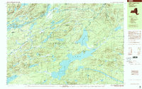
1999 Map of Little Tupper Lake
USGS Topo · Published 2001About this map
Little Tupper Lake serves as the central focal point for this late-twentieth-century study of the central Adirondacks. The landscape is defined by an intricate network of glacial ponds and interconnected waterways, including the winding Bog River and Lows Lake. Within the vast Adirondack Park, human presence is represented by the isolated outpost at Whitney Headquarters and the small settlements of Sabattis and Robinwood.
Find a feature on this map
63 named features on this map. Tap any name to fly to it.
Don’t see what you’re looking for? This feature index may not catch every label — zoom into the map to look around manually.
Map Details
Editions of this 1999 Little Tupper Lake Map
This is the sole edition of this map. No revisions or reprints were ever made.
Other maps of this area

1903 · Big Moose
USGS Topo · 1:62,500

1903 · Raquette Lake
USGS Topo · 1:62,500

1903 · Blue Mountain
USGS Topo · 1:62,500

1904 · Long Lake
USGS Topo · 1:62,500

1907 · Tupper Lake
USGS Topo · 1:62,500

1919 · Cranberry Lake
USGS Topo · 1:62,500

1921 · Cranberry Lake
USGS Topo · 1:62,500

1931 · Cranberry Lake
USGS Topo · 1:62,500

1948 · Ogdensburg
USGS Topo · 1:250,000

1950 · Utica
USGS Topo · 1:250,000