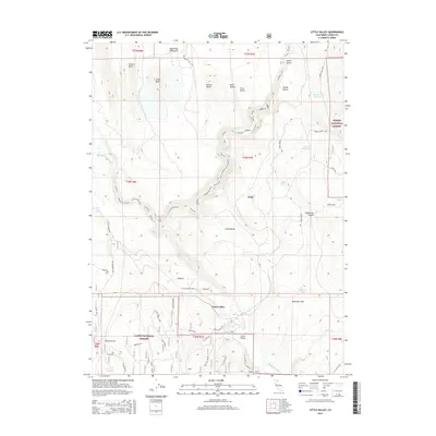
2015 Map of Little Valley
USGS Topo · Published 2015About this map
The Pit River winds through this high-elevation terrain where the Lassen National Forest and Modoc National Forest meet in northeastern California. Settlement is sparse, anchored by the community of Little Valley in the south and the small locality of Dixie further north. The landscape is defined by a series of prominent peaks in the Big Valley Mountains, including First Butte, Second Butte, Third Butte, and Fourth Butte, which overlook expansive basins like Muck Valley and Clark Valley.
Find a feature on this map
46 named features on this map. Tap any name to fly to it.
Don’t see what you’re looking for? This feature index may not catch every label — zoom into the map to look around manually.
Map Details
Editions of this 2015 Little Valley Map
This is the sole edition of this map. No revisions or reprints were ever made.
Other maps of this area

1886 · Lassen Peak
USGS Topo · 1:250,000

1886 · Modoc Lava Bed
USGS Topo · 1:250,000

1892 · Modoc Lava-Bed
USGS Topo · 1:250,000

1892 · Lassen Peak
USGS Topo · 1:250,000

1894 · Lassen Peak
USGS Topo · 1:250,000

1939 · Halls Flat
USGS Topo · 1:125,000

1954 · Alturas
USGS Topo · 1:250,000

1955 · Westwood
USGS Topo · 1:250,000

1957 · Little Valley
USGS Topo · 1:62,500

1957 · Jellico
USGS Topo · 1:62,500