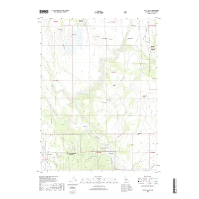
2018 Map of Little Valley
USGS Topo · Published 2018About this map
Little Valley sits at the heart of this landscape where forest and valley floor converge, serving as a primary point of settlement within the Lassen National Forest. The Pit River winds through the northern sections, cutting past First Butte and Second Butte, while the Big Valley Mountains dominate the northwestern horizon. This 2018 survey reveals a network of service roads and spurs, such as Loomis Cabin Rd and the W Little Valley Spur, which define access to timberlands and remote water sources like Hunter Spring. The transition from the high buttes to the lower elevations of Clarks Valley and Sunflower Flat illustrates the complex drainage patterns of the region, anchored by established landmarks like Loomis Reservoir and Spring Gulch Reservoir.
Find a feature on this map
47 named features on this map. Tap any name to fly to it.
Don’t see what you’re looking for? This feature index may not catch every label — zoom into the map to look around manually.
Map Details
Editions of this 2018 Little Valley Map
This is the sole edition of this map. No revisions or reprints were ever made.
Other maps of this area

1886 · Lassen Peak
USGS Topo · 1:250,000

1886 · Modoc Lava Bed
USGS Topo · 1:250,000

1892 · Modoc Lava-Bed
USGS Topo · 1:250,000

1892 · Lassen Peak
USGS Topo · 1:250,000

1894 · Lassen Peak
USGS Topo · 1:250,000

1939 · Halls Flat
USGS Topo · 1:125,000

1954 · Alturas
USGS Topo · 1:250,000

1955 · Westwood
USGS Topo · 1:250,000

1957 · Little Valley
USGS Topo · 1:62,500

1957 · Jellico
USGS Topo · 1:62,500