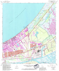
1967 Map of Little Woods
USGS Topo · Published 1994About this map
National Aeronautics and Space Administration facilities dominate the southeastern landscape of this New Orleans survey, highlighting the era's significant aerospace footprint in the region. The map captures a complex environment of expanding residential development and heavy infrastructure, where suburban blocks organized around Morrison Blvd and Dwyer Blvd push against the wetlands of the Lake Pontchartrain shoreline.
Find a feature on this map
39 named features on this map. Tap any name to fly to it.
Don’t see what you’re looking for? This feature index may not catch every label — zoom into the map to look around manually.
Map Details
Editions of this 1967 Little Woods Map
4 editions found
Other maps of this area

1891 · Spanish Fort
USGS Topo · 1:62,500

1891 · New Orleans
USGS Topo · 1:62,500

1892 · Chef Menteur
USGS Topo · 1:62,500

1892 · St. Bernard
USGS Topo · 1:62,500

1932 · New Orleans NE
USGS Topo · 1:31,680

1936 · North Shore
USGS Topo · 1:31,680

1936 · South Point
USGS Topo · 1:31,680

1936 · Chef Menteur
USGS Topo · 1:62,500

1936 · Spanish Fort
USGS Topo · 1:62,500

1937 · Chef Menteur
USGS Topo · 1:31,680
Featured Places
- New Orleans, LA
- Michoud, New Orleans
- Idlewood, New Orleans
- Versailles, New Orleans
- Kingswood, New Orleans