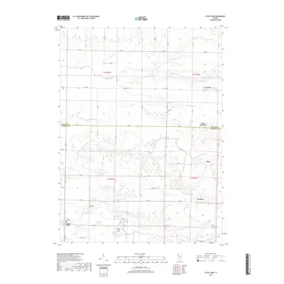
2018 Map of Little York
USGS Topo · Published 2018About this map
Little York serves as the primary hub of this Western Illinois landscape, situated at the intersection of several local routes in Warren County. The terrain is defined by a dense network of waterways, including Henderson Creek, Middle Henderson Cr, and N Henderson Cr, which carve through the agricultural tablelands. This drainage pattern shaped the placement of smaller nineteenth-century settlements and rail-oriented locales like Norwood, Alexis Junction, and Shaw.
Find a feature on this map
36 named features on this map. Tap any name to fly to it.
Don’t see what you’re looking for? This feature index may not catch every label — zoom into the map to look around manually.
Map Details
Editions of this 2018 Little York Map
This is the sole edition of this map. No revisions or reprints were ever made.
Other maps of this area

1921 · Monmouth
USGS Topo · 1:62,500

1923 · Monmouth
USGS Topo · 1:62,500

1923 · Alexis
USGS Topo · 1:62,500

1925 · Alexis
USGS Topo · 1:62,500

1934 · Oquawka
USGS Topo · 1:48,000

1935 · Keithsburg
USGS Topo · 1:48,000

1940 · Oquawka
USGS Topo · 1:62,500

1941 · Keithsburg
USGS Topo · 1:62,500

1953 · Viola
USGS Topo · 1:24,000
1953 · Aledo East
USGS Topo · 1:24,000