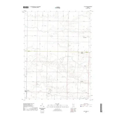
2021 Map of Little York
USGS Topo · Published 2021About this map
Little York and the surrounding agricultural uplands of Warren and Mercer Counties are defined by the intricate drainage of Henderson Creek and its many tributaries. This area, recorded in 2021, shows a landscape where historic village clusters like Norwood and Woodvale persist alongside an established grid of rural roads and county highways. The township boundaries and property lines follow a strict section-based geometry, interrupted only by the winding paths of Goose Run, Duck Cr, and Cedar Creek. For those tracing local history, the map identifies several well-maintained burial grounds, including Brownlee Cem and Cedar Creek Cem, which serve as quiet landmarks of early settlement. The presence of Lake Warren and Roney Lake in the southeast, along with the M A M Trail Airport, highlights the modern recreational and utility infrastructure that has integrated into this traditional farming region.
Find a feature on this map
51 named features on this map. Tap any name to fly to it.
Don’t see what you’re looking for? This feature index may not catch every label — zoom into the map to look around manually.
Map Details
Editions of this 2021 Little York Map
This is the sole edition of this map. No revisions or reprints were ever made.
Other maps of this area

1921 · Monmouth
USGS Topo · 1:62,500

1923 · Monmouth
USGS Topo · 1:62,500

1923 · Alexis
USGS Topo · 1:62,500

1925 · Alexis
USGS Topo · 1:62,500

1934 · Oquawka
USGS Topo · 1:48,000

1935 · Keithsburg
USGS Topo · 1:48,000

1940 · Oquawka
USGS Topo · 1:62,500

1941 · Keithsburg
USGS Topo · 1:62,500

1953 · Viola
USGS Topo · 1:24,000
1953 · Aledo East
USGS Topo · 1:24,000