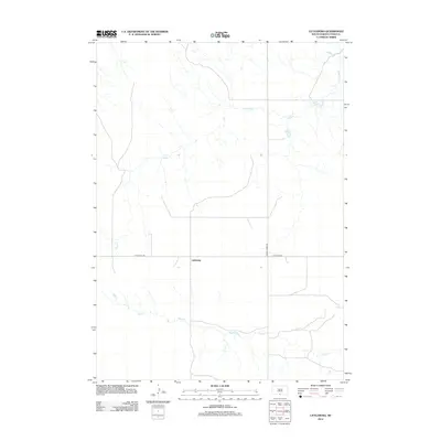
2012 Map of Littleburg
USGS Topo · Published 2012About this map
Littleburg serves as the central hub for this rural stretch of South Dakota, situated at the junction of Littleburg Rd and Hidden Timber Rd. The landscape is defined by the wandering drainage systems of the High Plains, with the northern reaches marked by the dendritic tributaries of Eagle Cr and the southern portion dominated by the winding course of Sand Cr. This 2012 survey illustrates the sparse, grid-based road network characteristic of Todd County, where infrastructure is designed to bridge vast distances between homesteads and ranching operations. The mapping of these ephemeral watercourses provides a detailed look at the local hydrology that has historically dictated the placement of settlements and transport routes in the Antelope Segment.
Find a feature on this map
5 named features on this map. Tap any name to fly to it.
Don’t see what you’re looking for? This feature index may not catch every label — zoom into the map to look around manually.
Map Details
Editions of this 2012 Littleburg Map
This is the sole edition of this map. No revisions or reprints were ever made.
Other maps of this area

1950 · Sparks
USGS Topo · 1:62,500

1950 · Valentine
USGS Topo · 1:62,500

1955 · Martin
USGS Topo · 1:250,000

1957 · Valentine
USGS Topo · 1:250,000

1958 · Martin
USGS Topo · 1:250,000

1959 · Valentine
USGS Topo · 1:250,000

1982 · Olsonville
USGS Topo · 1:24,000

1982 · Olsonville SE
USGS Topo · 1:24,000

1982 · Hidden Timber
USGS Topo · 1:24,000

1982 · Hidden Timber SE
USGS Topo · 1:24,000