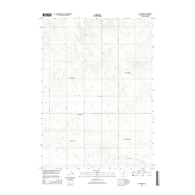
2015 Map of Littleburg
USGS Topo · Published 2015About this map
Littleburg sits at the center of this Todd County landscape, where the high plains of South Dakota are dissected by the drainage systems of Eagle Cr to the north and Sand Cr to the south. The area is defined by its rectilinear grid of section lines and rural roads, reflecting the legacy of the Public Land Survey System as seen in the boundaries of t36n r27w and t35n r26w. The terrain is characterized by intricate contouring that reveals the undulating breaks and draws typical of this portion of the Rosebud Indian Reservation area. Notable local thoroughfares such as Dam Ranch Rd, Cr-125, and 301st St provide the primary access through this sparsely populated ranching and agricultural country, connecting isolated homesteads to the small settlement node at Littleburg.
Find a feature on this map
12 named features on this map. Tap any name to fly to it.
Don’t see what you’re looking for? This feature index may not catch every label — zoom into the map to look around manually.
Map Details
Editions of this 2015 Littleburg Map
This is the sole edition of this map. No revisions or reprints were ever made.
Other maps of this area

1950 · Sparks
USGS Topo · 1:62,500

1950 · Valentine
USGS Topo · 1:62,500

1955 · Martin
USGS Topo · 1:250,000

1957 · Valentine
USGS Topo · 1:250,000

1958 · Martin
USGS Topo · 1:250,000

1959 · Valentine
USGS Topo · 1:250,000

1982 · Olsonville
USGS Topo · 1:24,000

1982 · Olsonville SE
USGS Topo · 1:24,000

1982 · Hidden Timber
USGS Topo · 1:24,000

1982 · Hidden Timber SE
USGS Topo · 1:24,000