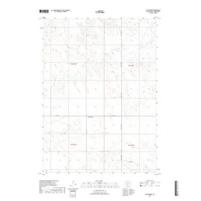
2017 Map of Littleburg
USGS Topo · Published 2017About this map
The settlement of Littleburg serves as the focal point for this survey of the Antelope Segment in Todd County. The landscape is defined by the drainage patterns of Eagle Cr and Sand Cr, which carve through the high plains of the Rosebud Indian Reservation. Transportation in this part of the Great Plains is marked by long stretches of rural routes, including Hidden Timber Rd and Littleburg Rd, which intersect at the small community center. The transition between the northern and southern townships—t36n r27w and t35n r27w—is clearly delineated, showing a modern landscape of large land parcels and remote ranch access roads like Dam Ranch Dr. This map provides a clear record of the area's hydrology and secondary road network at the end of the 2010s.
Find a feature on this map
10 named features on this map. Tap any name to fly to it.
Don’t see what you’re looking for? This feature index may not catch every label — zoom into the map to look around manually.
Map Details
Editions of this 2017 Littleburg Map
This is the sole edition of this map. No revisions or reprints were ever made.
Other maps of this area

1950 · Sparks
USGS Topo · 1:62,500

1950 · Valentine
USGS Topo · 1:62,500

1955 · Martin
USGS Topo · 1:250,000

1957 · Valentine
USGS Topo · 1:250,000

1958 · Martin
USGS Topo · 1:250,000

1959 · Valentine
USGS Topo · 1:250,000

1982 · Olsonville
USGS Topo · 1:24,000

1982 · Olsonville SE
USGS Topo · 1:24,000

1982 · Hidden Timber
USGS Topo · 1:24,000

1982 · Hidden Timber SE
USGS Topo · 1:24,000