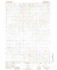
1982 Map of Littleburg
USGS Topo · Published 1982About this map
Littleburg stands as the primary settlement on this landscape where the high plains of South Dakota meet the northern edge of Nebraska. Surveyed in the early 1980s, the terrain is defined by its drainage systems, most notably the winding paths of Eagle Creek to the north and Sand Creek in the south. The map documents a significant political and cultural geography, showing the Indian Reservation Boundary and the convergence of Todd Co and Cherry Co. This document captures the sparse, rural nature of the borderlands during this era, where the South Dakota Nebraska line bisects a territory otherwise unified by its rolling topography and shared waterways. The placement of section lines and township markers provides a clear framework for researchers tracing 20th-century land use and ownership in the region.
Find a feature on this map
8 named features on this map. Tap any name to fly to it.
Don’t see what you’re looking for? This feature index may not catch every label — zoom into the map to look around manually.
Map Details
Editions of this 1982 Littleburg Map
This is the sole edition of this map. No revisions or reprints were ever made.
Other maps of this area

1950 · Sparks
USGS Topo · 1:62,500

1950 · Valentine
USGS Topo · 1:62,500

1955 · Martin
USGS Topo · 1:250,000

1957 · Valentine
USGS Topo · 1:250,000

1958 · Martin
USGS Topo · 1:250,000

1959 · Valentine
USGS Topo · 1:250,000

1982 · Olsonville
USGS Topo · 1:24,000

1982 · Olsonville SE
USGS Topo · 1:24,000

1982 · Hidden Timber
USGS Topo · 1:24,000

1982 · Hidden Timber SE
USGS Topo · 1:24,000