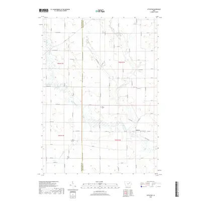
2018 Map of Littleton
USGS Topo · Published 2018About this map
The Wapsipinicon River and its various tributaries, including the Little Wapsipinicon River, Crane Creek, and Buck Cr, define the landscape of this rural corridor along the border of Black Hawk and Buchanan counties. The settlement of Littleton sits at the river's edge, serving as a focal point for the surrounding agricultural townships. Further south, the map documents the area of Barclay, where land use patterns are interspersed with numerous small cemeteries that reflect the early generations of local settlers. Genealogists and historians can identify several distinct burial grounds, such as Old Barclay Cemetery, New Barclay Cemetery, and the Amish Cemetery. These sites, along with Saint Michaels Cemetery and Union Cemetery, are distributed across the section lines, highlighting the importance of family and faith communities in this part of eastern Iowa.
Find a feature on this map
75 named features on this map. Tap any name to fly to it.
Don’t see what you’re looking for? This feature index may not catch every label — zoom into the map to look around manually.
Map Details
Editions of this 2018 Littleton Map
This is the sole edition of this map. No revisions or reprints were ever made.
Other maps of this area

1901 · Oelwein
USGS Topo · 1:125,000

1903 · Winthrop
USGS Topo · 1:125,000

1954 · Waterloo
USGS Topo · 1:250,000

1955 · Waterloo
USGS Topo · 1:250,000

1959 · Dubuque
USGS Topo · 1:250,000

1961 · Dubuque
USGS Topo · 1:250,000

1962 · Dubuque
USGS Topo · 1:250,000

1971 · Readlyn
USGS Topo · 1:24,000

1971 · Gilbertville
USGS Topo · 1:24,000

1971 · Dunkerton
USGS Topo · 1:24,000