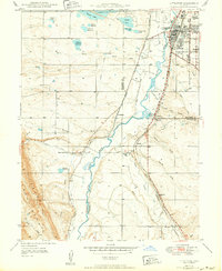
1942 Map of Littleton
USGS Topo · Published 1950About this map
The South Platte River and its accompanying irrigation network anchor this mid-century view of the area south of Denver. The town of Littleton is shown at a pivotal moment of transition, still largely concentrated near the Atchison Topeka and Santa Fe RR and Denver and Rio Grande Western RR corridors, before the post-war suburban expansion fully reshaped the landscape. Landmarks of the era include the Arapahoe Co Fairgrounds, the Monastery, and the local High Sch.
Find a feature on this map
53 named features on this map. Tap any name to fly to it.
Don’t see what you’re looking for? This feature index may not catch every label — zoom into the map to look around manually.
Map Details
Editions of this 1942 Littleton Map
2 editions found

Other maps of this area

1890 · East Denver
USGS Topo · 1:125,000

1893 · Platte Canyon
USGS Topo · 1:125,000

1894 · Castle Rock
USGS Topo · 1:125,000

1899 · West Denver
USGS Topo · 1:125,000

1913 · Castle Rock
USGS Topo · 1:125,000

1935 · East Denver Nos. 3 and 4
USGS Topo · 1:48,000

1938 · Morrison
USGS Topo · 1:24,000

1940 · Englewood
USGS Topo · 1:31,680

1940 · Castle Rock
USGS Topo · 1:62,500

1941 · Fort Logan
USGS Topo · 1:31,680