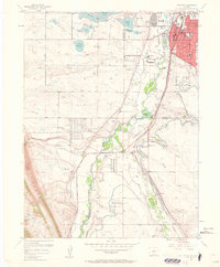
1957 Map of Littleton
USGS Topo · Published 1961About this map
Littleton serves as the focal point of this late-1950s landscape, where the urban expansion of the Denver area meets the water-rich plains and dramatic rise of the Hogback. The South Platte River valley is a hub of industrial and recreational activity, featuring the Centennial Racetrack and the Columbine Country Club. The map reveals a complex water management system vital to the region's growth, including Marston Lake, Bowles Lake, and the nearby Filtration Plant. Parallel rail lines of the Atchison Topeka and Santa Fe and the Denver and Rio Grande Western track the river south toward Acequia, illustrating the historic transport corridor's importance. Further south, the rural character remains evident around Plum Creek Sch and the small settlement of Waterton, while spiritual and community landmarks like the Carmelite Monastery and St Marys Sch anchor the burgeoning town center.
Find a feature on this map
56 named features on this map. Tap any name to fly to it.
Don’t see what you’re looking for? This feature index may not catch every label — zoom into the map to look around manually.
Map Details
Editions of this 1957 Littleton Map
2 editions found
Other maps of this area

1890 · East Denver
USGS Topo · 1:125,000

1893 · Platte Canyon
USGS Topo · 1:125,000

1894 · Castle Rock
USGS Topo · 1:125,000

1899 · West Denver
USGS Topo · 1:125,000

1913 · Castle Rock
USGS Topo · 1:125,000

1935 · East Denver Nos. 3 and 4
USGS Topo · 1:48,000

1938 · Morrison
USGS Topo · 1:24,000

1940 · Englewood
USGS Topo · 1:31,680

1940 · Castle Rock
USGS Topo · 1:62,500

1941 · Fort Logan
USGS Topo · 1:31,680