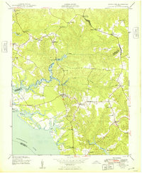
1948 Map of Litwalton
USGS Topo · Published 1948About this map
The Rappahannock River defines the southern reach of this Northern Neck landscape, where the tides push into Mulberry Creek and Deep Creek. Inland from the river, the settlement pattern follows the high ground between winding drainage systems like Balls Branch and Lancaster Creek. Small rural crossroads and community centers serve as the primary landmarks, including the eponymous Litwalton, Nuttsville, and Pierces Corner.
Find a feature on this map
36 named features on this map. Tap any name to fly to it.
Don’t see what you’re looking for? This feature index may not catch every label — zoom into the map to look around manually.
Map Details
Editions of this 1948 Litwalton Map
2 editions found
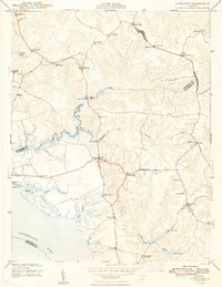
Other maps of this area

1916 · Kilmarnock
USGS Topo · 1:48,000

1917 · Heathsville
USGS Topo · 1:48,000

1917 · Urbanna
USGS Topo · 1:62,500

1917 · Morattico
USGS Topo · 1:62,500

1917 · Kilmarnock
USGS Topo · 1:62,500

1918 · Morattico
USGS Topo · 1:62,500

1926 · Morattico
USGS Topo · 1:62,500

1942 · Kilmarnock
USGS Topo · 1:62,500

1943 · Richmond
USGS Topo · 1:250,000

1944 · Morattico
USGS Topo · 1:31,680