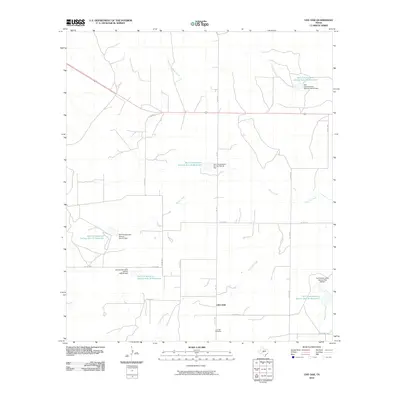
2010 Map of Live Oak
USGS Topo · Published 2010About this map
Live Oak sits within a landscape defined by water management and ranching in Concho County. This 2010 survey reveals an intricate network of local roads such as FM 176 and Co RD 2041 that connect isolated homesteads and grazing lands. The most striking human-made features are the numerous reservoirs created for land management, including Soil Conservation Service Site 33 Reservoir and Soil Conservation Service Site 30 Reservoir, each accompanied by its own namesake dam. These sites illustrate the region's focus on soil conservation and water security in a territory drained by Brady Creek and Live Oak Creek. For those tracing family history, the Live Oak Cemetery provides a primary point of reference in this sparsely populated portion of the Texas Edwards Plateau. The drainage patterns of Middle Kickapoo Creek and Fitzgerald Creek further define the local topography, marking the natural boundaries between the various county roads that crisscross the quadrangle.
Find a feature on this map
29 named features on this map. Tap any name to fly to it.
Don’t see what you’re looking for? This feature index may not catch every label — zoom into the map to look around manually.
Map Details
Editions of this 2010 Live Oak Map
This is the sole edition of this map. No revisions or reprints were ever made.
Other maps of this area

1892 · San Angelo
USGS Topo · 1:125,000

1892 · Eden
USGS Topo · 1:125,000

1896 · Eden
USGS Topo · 1:125,000

1954 · Brownwood
USGS Topo · 1:250,000

1954 · San Angelo
USGS Topo · 1:250,000

1957 · Eola
USGS Topo · 1:62,500

1958 · San Angelo
USGS Topo · 1:250,000

1965 · San Angelo
USGS Topo · 1:250,000

1967 · Millersview SE
USGS Topo · 1:24,000
1967 · Millersview SW
USGS Topo · 1:24,000