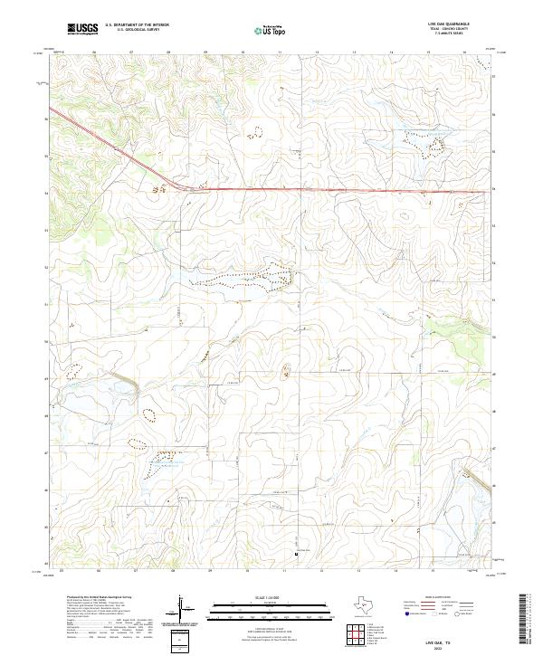
2022 Map of Live Oak
USGS Topo · Published 2022About this map
Live Oak Cem sits in the southern portion of this Concho County landscape, serving as a primary focal point for local family history and genealogical research. The terrain is defined by a dendritic network of seasonal waterways, including Middle Kickapoo Cr and Brady Cr, which drain the open ranchland. Modern land management is evident through large-scale hydrological engineering, specifically the Soil Conservation Service Site 33 Reservoir and Soil Conservation Service Site 30 Reservoir. These structures illustrate the mid-to-late 20th-century movement to manage watershed runoff in West Texas. Transport across the region is anchored by the corridor of highway 87, while a grid of county roads such as Co RD 2041 and FM 176 provides access to the dispersed agricultural properties and natural drainages like Live Oak Cr.
Find a feature on this map
21 named features on this map. Tap any name to fly to it.
Don’t see what you’re looking for? This feature index may not catch every label — zoom into the map to look around manually.
Map Details
Editions of this 2022 Live Oak Map
This is the sole edition of this map. No revisions or reprints were ever made.
Other maps of this area

1892 · San Angelo
USGS Topo · 1:125,000

1892 · Eden
USGS Topo · 1:125,000

1896 · Eden
USGS Topo · 1:125,000

1954 · Brownwood
USGS Topo · 1:250,000

1954 · San Angelo
USGS Topo · 1:250,000

1957 · Eola
USGS Topo · 1:62,500

1958 · San Angelo
USGS Topo · 1:250,000

1965 · San Angelo
USGS Topo · 1:250,000

1967 · Millersview SE
USGS Topo · 1:24,000
1967 · Millersview SW
USGS Topo · 1:24,000